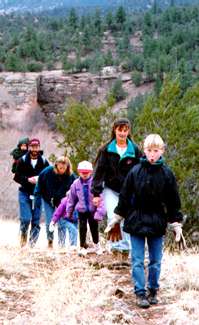
The Wilderness Lodge is your doorway to a landscape of fantastic walks and hikes, ranging from gentle strolls in the forest to a challenging hikes across country — and the most challenging of all, the Mexico-to-Canada Continental Divide Trail.
We're here to help you find the trails suited to your desires, and we can help you find fantastic hikes you won't find on most maps or trail guides. Here are just a few guidelines and trails to consider!
 Maps
Maps
We recommend the USDA Forest Service "Gila Wilderness" map for all of the following hikes. It is available at the Gila Cliff Dwellings Visitor Center or any District Ranger office on the Gila National Forest.
To order one by phone with a credit card, call (575) 536-9344. To order by mail write to the SW Parks and Monuments Association, HC 68 Box 100, Silver City, NM 88061. The map is $9.00, plus $2.00 postage. They also have USGS topo maps covering the Gila Wilderness for $6 each.
Be Careful
Flash floods, dehydration, rattlesnakes and mountain lions are just some of the more glamorous ways to hurt yourself in the Wilderness. Carry a map, compass, extra food, water (or a way to treat water), extra clothing, matches, and don't forget the common sense.
Conditions can change. The authors of this web site make no representation as to the advisability of leaving the comfort and safety of your living room. You are responsible for your own safety and well being.
EE Canyon Loop
8 miles
Moderate
Take Trail #l60 from Woody's Corral up "Thousand Mile Ridge" for about 3 miles. After turning right towards McKenna Park, the trail goes along a narrow ridge, on your right is the head of Cliff Dweller canyon. After going 3/4 of a mile, take a right and hike 2 miles down EE canyon, through an area that was formerly green and shady, but now, as you will have noticed earlier in the hike, has been scorched by the Miller fire during the summer of 2011. Keep an eye open for the spring. When you run into the West Fork, hike downstream to the Cliff Dwellings parking lot and then 1 mile down the road back to Woody's Corral.
Little Bear Canyon
8 miles round trip
Moderate
The Little Bear trail connects the West Fork with the Middle Fork of the Gila River. It is popular because of the beautiful deep gorge the trail drops into towards the end of the hike. At certain times of the year, ferns and columbine line the trail.
The trail begins at TJ corral and initially climbs up on a ridge, then drops into a side canyon of Little Bear and finally into Little Bear canyon. The last 1/2 mile is extremely narrow . This canyon has a danger of flash floods during rainy season. The trail ends at the Middle Fork of the Gila. To return, hike back the way you came. More adventurous hikers could return by hiking down the Middle Fork, but start early and bring lunch, you will be crossing the river many many times. From this point you also could continue on 2 miles upstream (14 river crossings) to the Jordan Canyon hot springs. Most people do this as an overnight trip.
Middle Fork Hot Springs
3/4 mile one way
Easy
This is an easy 3/4 mile hike to one of the hottest hot springs in the Gila. It starts near the Gila Cliff Dwellings Visitor Center. Drive through the Visitor Center parking lot and up the hill 100 feet to the Middle Fork Trailhead on the left. Park here and follow the trail down the hill. Cross the river twice, the main hot springs are situated beside the river on the east bank, twenty feet below a smoke blackened cave.
Rocks around the edges of the pools can be moved to allow more or less river water in to cool the 150 degree hot springs water. The pools are in gravel bar immediately next to the river, and may be unusable during periods of high water. A shovel or an old coffee can comes in handy to dig the pools out - they tend to fill in with sand.
TJ Corral Stock Loop
4.5 miles
Easy
Start hiking at TJ Corral, take the left fork at the first junction (the trail sign will point towards the West Fork). The trail roughly parallels the road for about 2.5 miles, then intersects the West Fork Trail. Follow this trail downstream to the Cliff Dwellings parking lot, then walk the road 1 mile south to TJ Corral.
West Fork Loop
11 miles
Moderate
Start hiking at TJ Corral, take the right fork at the first junction. Climb up the ridge for about 2 miles. Take a left at the junction with the Meadows Trail (#l64). You'll be hiking on a ridge between the West Fork and Middle Fork of the Gila River. Turn left at the junction with Trail #28 (Zigzag Trail) to descend approximately 3 miles to the West Fork. Hike 1 mile downstream to the Cliff Dwellings parking lot, then 1 mile down the highway to TJ Corral. Return to the Wilderness Lodge for a well deserved soak in our hot pool.